It was 5 o’clock Friday afternoon and we were eagerly getting ready for a once in a lifetime Alaska Adventure via the Alaska Highway the following Monday. We’d been planning and preparing for this trip for nearly a year now. The Inn Sitters, Gary n Norma of Inn Time 4U had arrived on Tuesday and were diligently learning the ropes of our B&B and Cabins. And we were doing the final preparations and packing for this long, awaited adventure.
Since we were traveling with our travel trailer, I had been checking online to see what items we would be allowed and needed to bring as we ventured across the border into Canada. One of the items that appeared was “passport”. Oh my goodness. I discovered a couple of months ago I’d misplaced my passport (for whatever reason I hadn’t returned it to the secure file I normally keep it in). I had applied to cancel the current passport and acquire a new one 6 weeks ago and realized I still didn’t have it. The agent at the Columbia Falls post office informed me I’d have it in 4-6 weeks and my check to the Department of State for the passport had cleared my bank over 5 weeks ago.
I took a chance and called the national passport help line that Friday evening and was surprised to get a real person on the other end of the line. She seemed to be very helpful and told me my passport was still being processed in the Seattle office. After informing her I was scheduled to travel on Monday to Canada, she sent a message to the Seattle office to contact me Monday.
Brainstorming with one of the guests over the weekend, he suggested maybe I could pick it up at the Seattle office. That got me thinking out of the box, we didn’t need to travel through Jasper National Park on our way to Dawson Creek, BC – Milepost 0 of the Alaska Highway. Even though it would take us a couple of days longer, we could travel to Seattle first, pick up my passport, and then head for Dawson Creek.
But I also realized for that to work, I needed to talk directly with the Seattle office to make sure they’d hold my passport for me. Monday morning I called the national passport help line again but this time requesting the phone number of the Seattle office. I was informed they didn’t have a phone number for the Seattle office. REALLY??? Needless to say, I was not a happy camper – literally.
As I was ranting, Norma suggested I call 411 information to see if they might have a number for the Seattle office. To my amazement, I not only got a phone number via text, it called the number for me and I got right through. The gal who answered the phone was very helpful.
The Seattle representative informed me there was a problem with my application and I should have received a letter, which I had not. She was going to pass the information on to the person handling my case and said I’d receive a call shortly. To my amazement, I received a call back within an hour.
It seems the agent at the Columbia Falls, MT post office had neglected to sign my application. Apparently, they had sent it back to him to sign and he had not yet returned it. At that point, I requested they either send it to me overnight or let me pick it up in Seattle. Because they still didn’t have the application back from the agent they couldn’t send it overnight. But picking it up in Seattle was an option, and the next best thing.
Laticia at the Seattle office was wonderful. She would have my passport ready Monday afternoon and I’d pick it up sometime on Tuesday. She informed me exactly what I could expect when I arrived, which windows I’d be able to pick it up at, and not to pay for long term parking as it would take less than ½ hour. Well, since we were towing a travel trailer, finding parking in downtown Seattle would be a challenge!
Scott dropped me off in front of the building and while I was waiting my turn he was driving around downtown Seattle, up and down the steep 18% grade hilly streets. We arrived at the Passport Services Building in Seattle around 11:45 am and by 12:15 pm we were headed north to Canada – passport in hand.
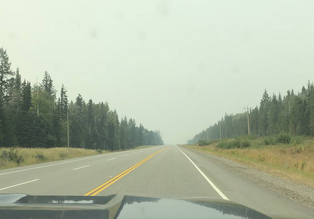
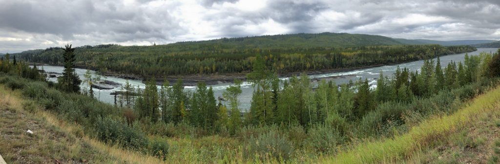
With a last-minute plan in place, we still left on Monday, a little later than originally planned and now heading for Seattle instead of Jasper National Park. The skies were filled with a smoky haze as we traveled the 726 miles out to Seattle then up to Hope, BC on Day 1 and Day 2. But on Day 3, traveling up Caribou Highway from Hope, BC to Williams Lake, BC, we were unable to see much of the scenic Frazier River and Thompson River gorges due to smoke from the BC wildfires – a little disappointing.
As we traveled north of Williams Lake, BC, the haze continued to get worse and visibility was very poor – less than ¼ mile. There wasn’t much scenery we could see along the 392 miles we traveled of the scenic Caribou Highway. We camped at Prince George, BC that night, which turned out to be the worst of the smoky haze. It was a nice cool night, great for sleeping but who wanted to have the windows open and breath smoke all night long. By morning, everything was covered with ash.
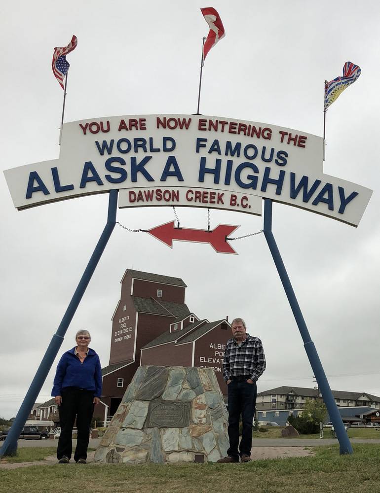
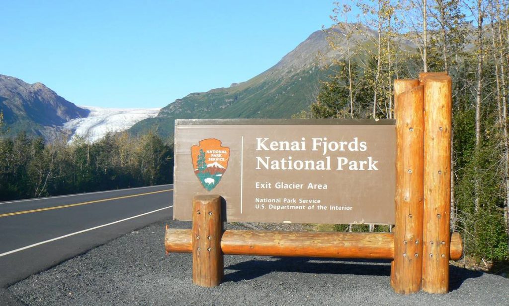
We continued north on Day 4, hoping we’d drive out of the smoky haze. When we arrived in Dawson Creek, BC that evening after traveling 250 miles, we welcomed the cloudy almost smoke free skies, a slight mist, and 50° temperatures. We got camp set up and set off to take in some activities around Dawson Creek. Of course, I had to have a picture of Milepost 0 along with the Historic Milepost 0. And then we checked out the Alaska Highway House which documented the building of the Alaska Highway. We settled into camp early that evening, enjoying the cool, relatively smoke free air.
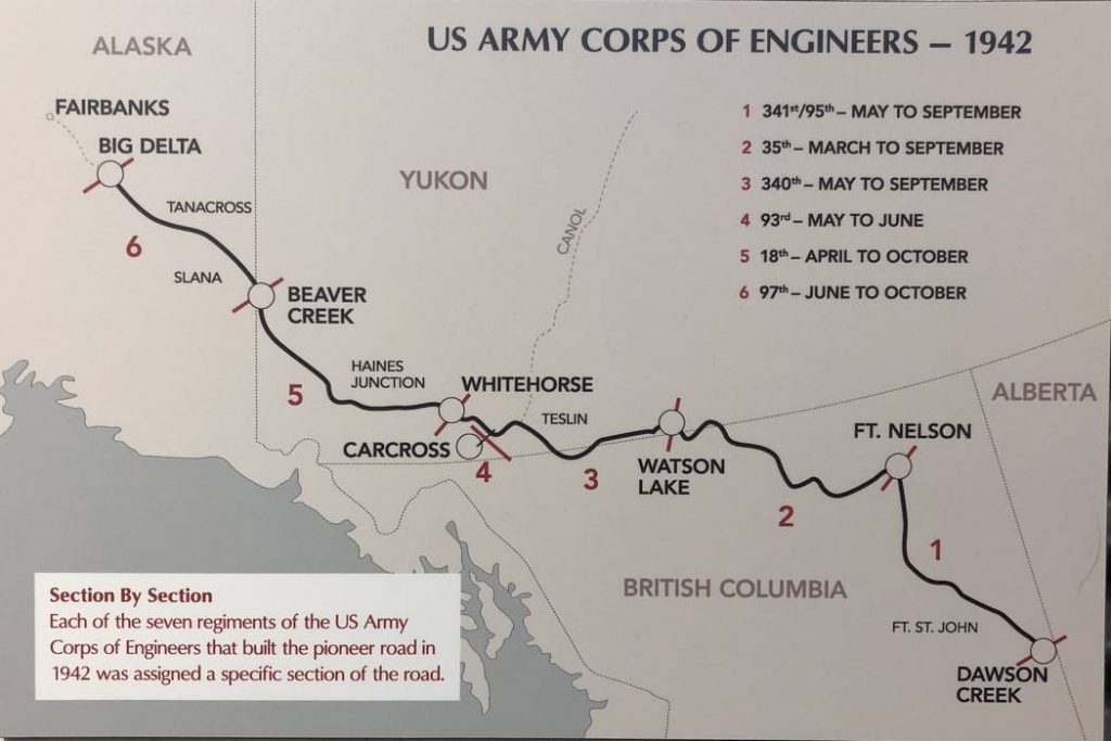
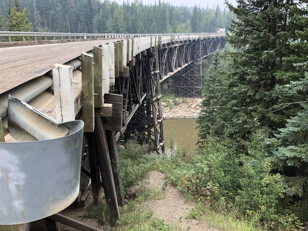
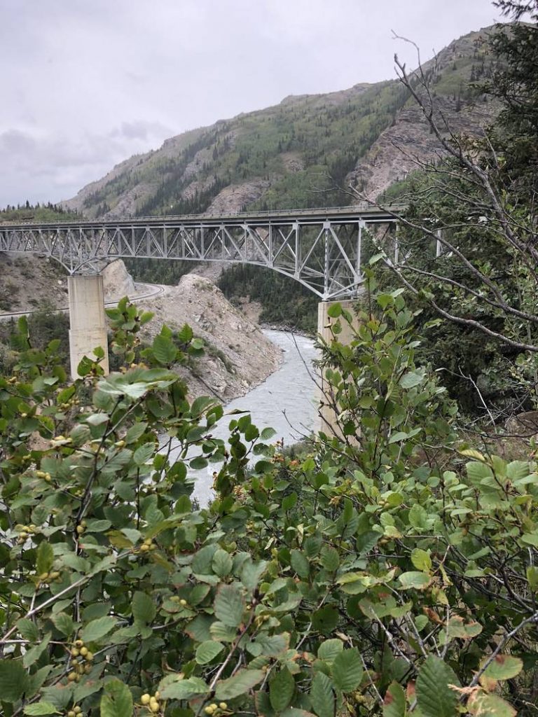
On Day 5 we began heading north on the Alaska Highway. At Historic Milepost 21, we took the opportunity to travel a portion of the Old Alaska Highway and over the Historic Kiskatinaw River Bridge. This is a 531 foot, curved bridge and is the only original timber bridge left along the Alaska Highway.
It was a little disappointing to discover most of the kilometer posts were missing for the first several miles along the Alaska Highway. We’d marked historic items to stop and see in our Milepost Travel Planner and by the time we’d determined which kilometer post we were at, we’d already passed the historic item. Pulling a travel trailer, you don’t turn around just anywhere, so we kept going. About 100 miles up the road the frequency of the kilometer posts became better but due to the foggy and still some smoky skies, there wasn’t a lot of scenery visible at the scenic lookouts.
After traveling 282 miles, we arrived at Fort Nelson, BC for the night, set up camp, and we were off to visit Ye Olde Quilt Shoppe. They had some great wildlife fabric so, yes, I bought a few things. Then we paid a visit to the Fort Nelson Heritage Museum which was conveniently located right next to the RV park. They had all kinds of items from antique telephones, to many antique vehicles in working condition, to wildlife mounts, to antique tools used during the construction of the Alaska Highway, to memorabilia from World War II. We came back to camp, settled in, and enjoyed another great, cool sleeping night.
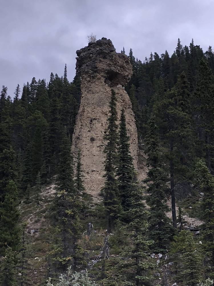
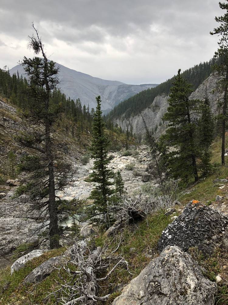
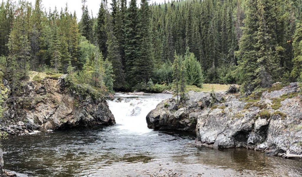
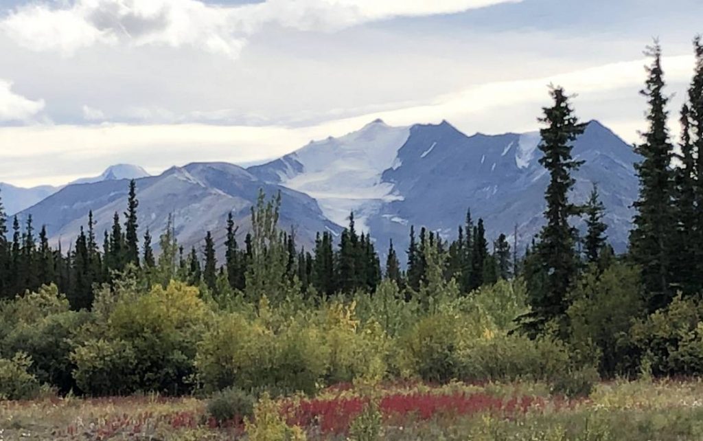
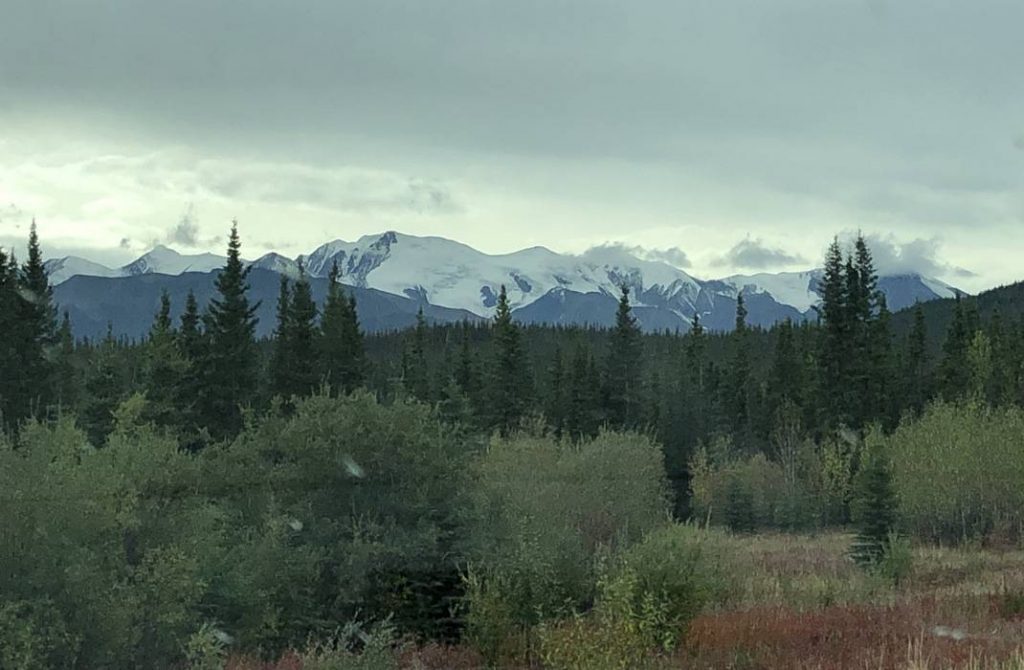
Day 6 brought us smoke free skies – very welcomed – and on and off rain – also welcomed. But it was clear enough to get some mountain views, although they were a little socked in with fog. It even stopped raining long enough for us to do a couple of short hikes – the Erosion Pillar Trail and Baba Canyon Trail.
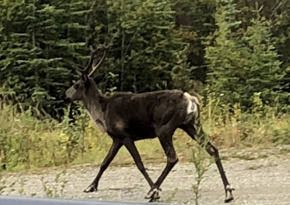
After seeing signs and warnings for hundreds of miles to watch for different wildlife species, we finally saw a lone caribou along the highway. We tried not to spook him too much. And, of course, we had to stop in Toad River to pick up souvenirs and take some pictures. We even got a little glimpse of the sun and blue sky at one point. Because we stopped at Summet Lake (the highest point on the Alaska Highway) and took in a couple of hikes, we had a shorter travel day of 149 miles before stopping for the night at Muncho Lake.
Camping on Muncho Lake was gorgeous – too bad it was still raining. We considered staying a 2nd night but come morning it was pouring rain and all socked in – not a good day to rent a canoe and spend time fishing on the lake!
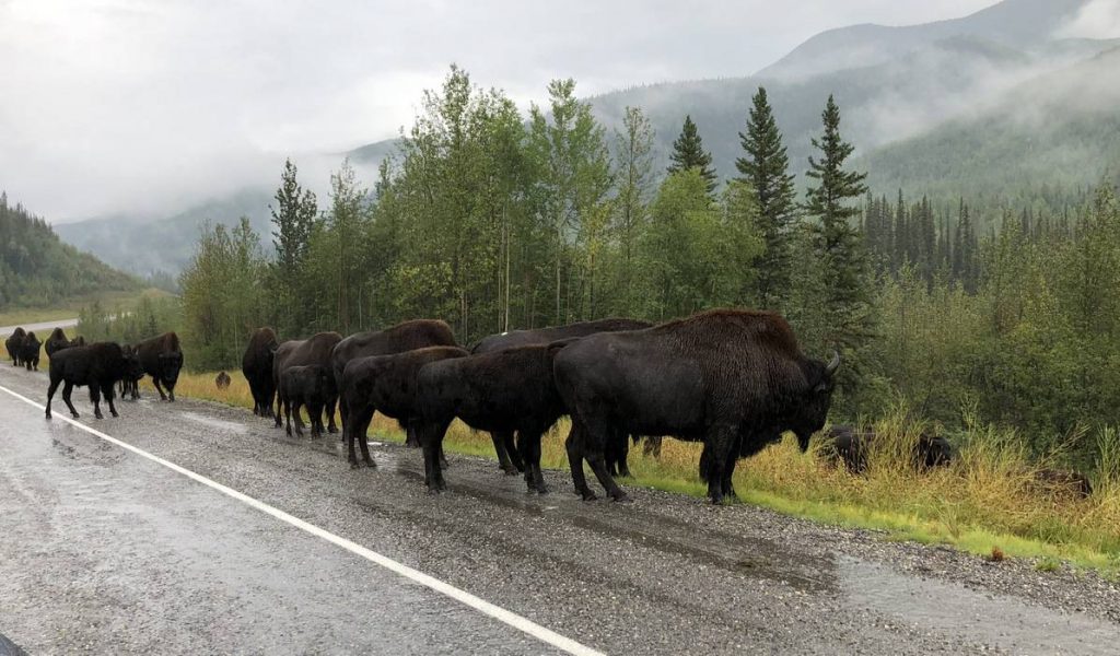
So, on Day 7 we headed up the road with the hopes we’d drive out of that rainy, cloudy weather. And believe it or not, we actually did. For the first time on this adventure, we had partly sunny skies with great mountain views. And it was even smoke free! Before we moved past the rain, we had our second wildlife viewing, a herd of wood bison right along the side of the road. Yep, a traffic jam.
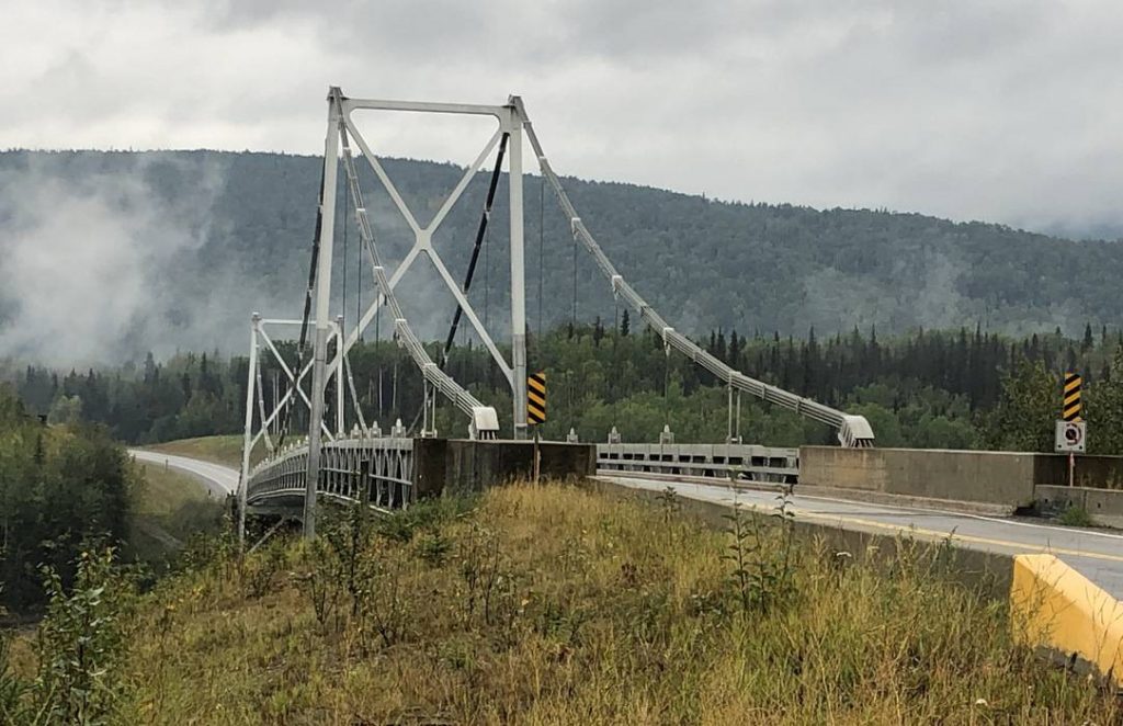
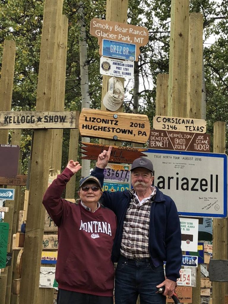
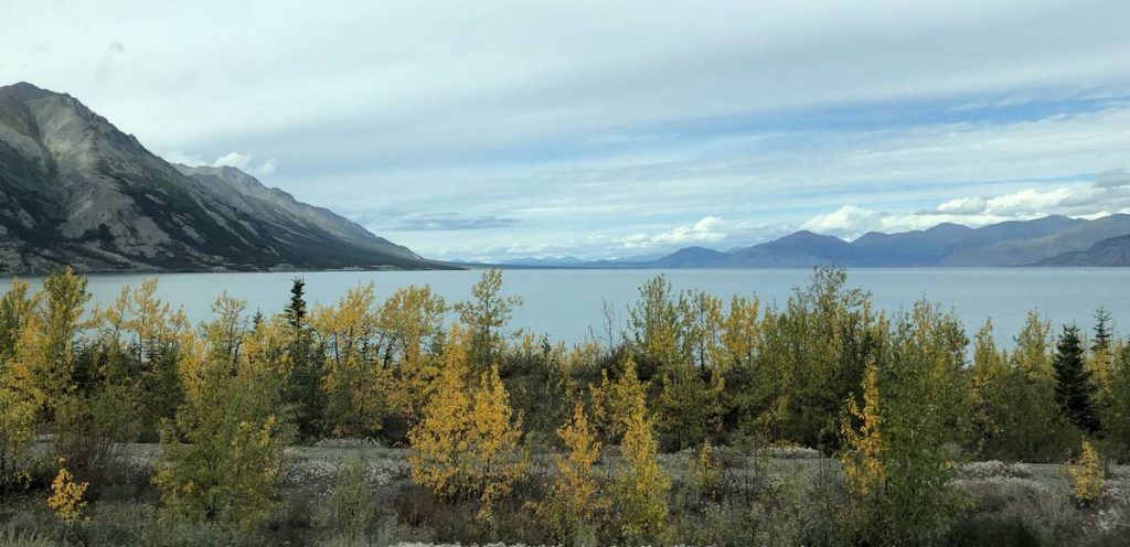
As we headed north the rest of the 332 miles to Teslin, YT, we crossed the only remaining suspension bridge on the Alaska Highway, over the Laird River – 1,143 feet long. We took in the Cranberry Rapids on the Laird River. And, of course, we hung our sign in the Sign Forest in Watson Lake, YT. The last stop on this leg was a short hike to view Rancheria Falls on the Rancheria River. That evening we set up camp along the Nisutlin Bay on Teslin Lake – in the sun!
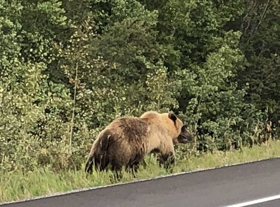
We started out Day 8 in the rain and all socked in again – lost the mountain peaks in the clouds. But as we drove west and then north, we left the rain behind and got our third wildlife viewing – a young grizzly bear along the road. At first, we couldn’t figure out why a car was stopped in the middle of the road, but soon enough it was obvious.
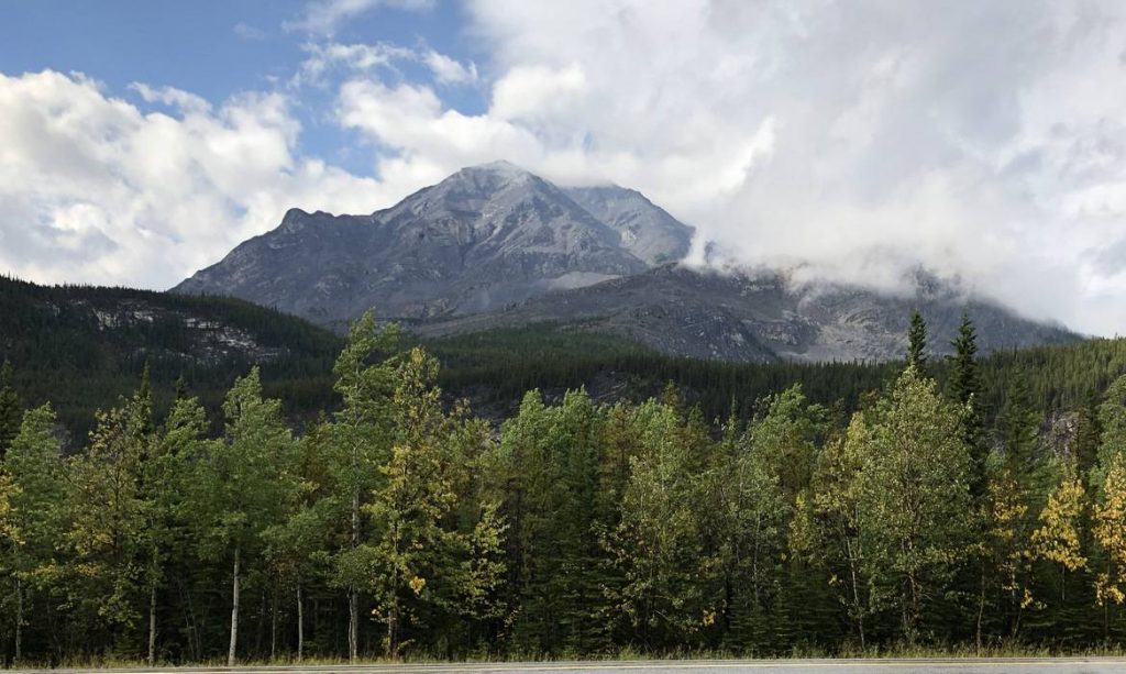
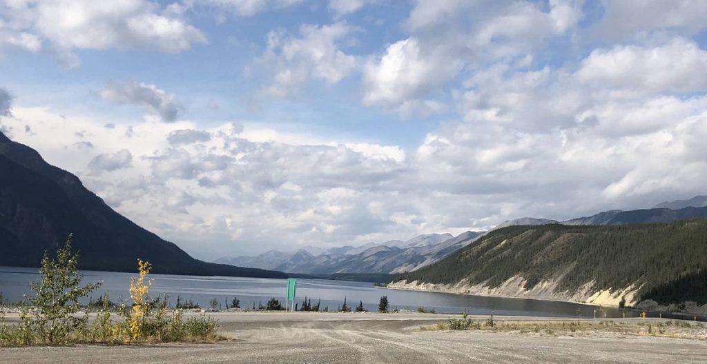
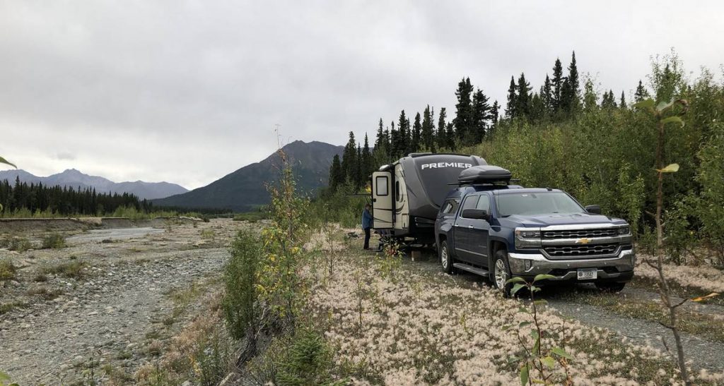
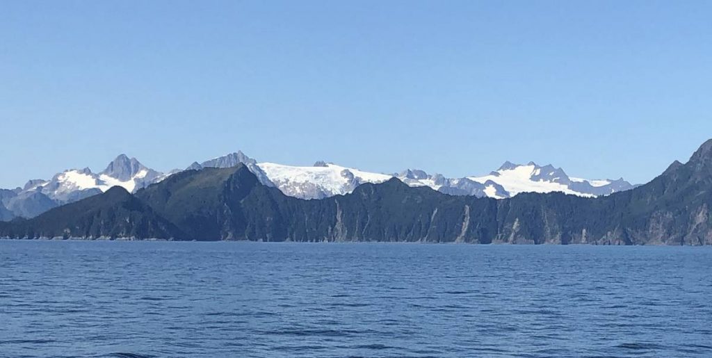
It cleared up enough in the afternoon and we got some great views of the Kluane Mountain Range and the glaciers residing there. The drive along Kluane Lake was beautiful and after traveling 331 miles, we found a completely off the grid place to camp – next to Edith Creek. It was great sitting outside in the cool evening listening to the creek flow by without any other disturbances.

Even though Day 9 started off again with rain, fog, and all socked in, Scott took the time to cast a fly or two (or three) into Edith Creek before we headed on up the road. He landed a 16” long grayling who promptly took off with his orange stimulator just as he was about to release it. No pictures of that catch!!
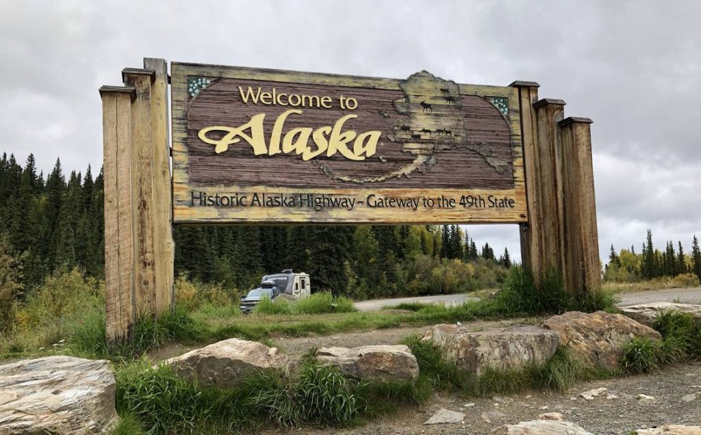
We headed up the road in the rain, and, like previous days, we drove out of it. We got some nice lake and mountain views, crossed into Alaska, and found a place to set up camp in Tok. Part of this 165 mile stretch was under construction in the Yukon shortly before the Alaska border. With all the recent rain, the truck and trailer became covered in mud. First order of business when we got to camp – give both the truck and trailer a bath. And it’s going to be another nice cool night for sleeping.
It’s been interesting traveling across the portion of the Alaska Highway built on the permafrost. Every time we stopped to set up camp, we needed to reorganize everything in the travel trailer. Sometimes, it even became a major hunt to find an item as it had done a little traveling of its own each time we passed over another frost heave in the road. The frost heaves from the road being built on permafrost ground always give the road crews a section of highway to repair each summer. We found it amusing once we reached Alaska as the heaves were marked with tin pie plates stapled to a stake. I guess it was an easy and inexpensive way to mark those every changing frost heaves.
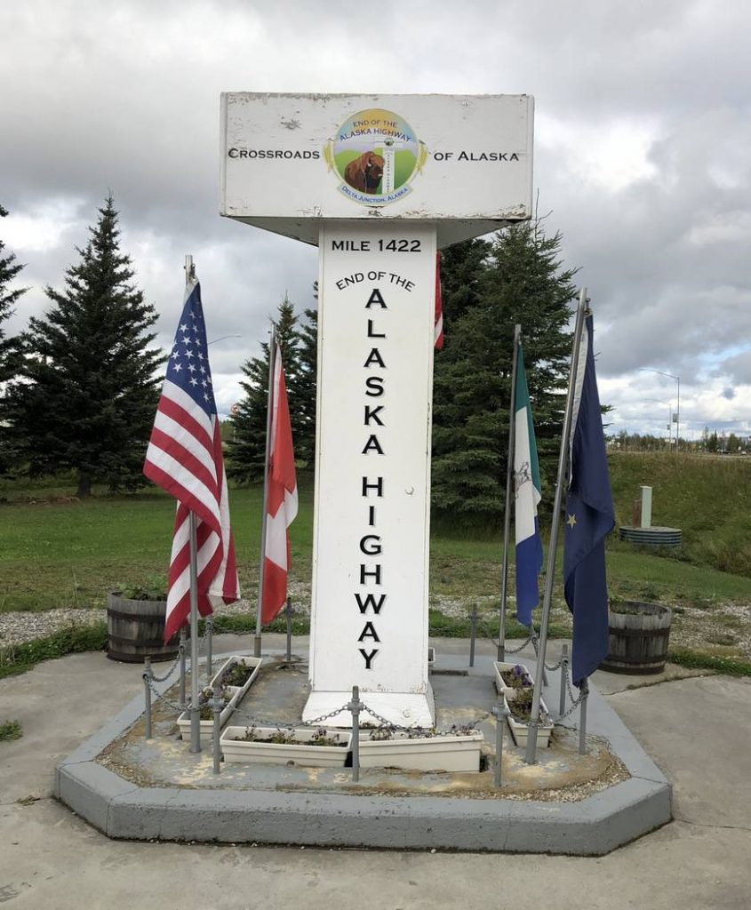
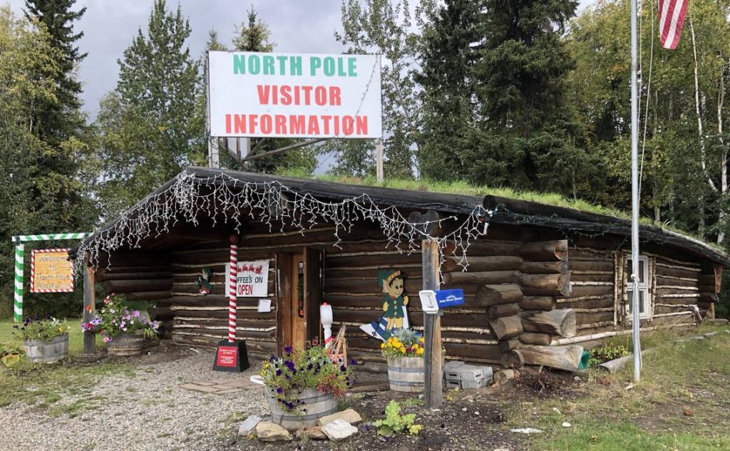
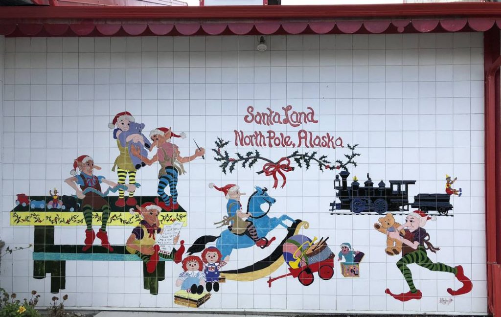
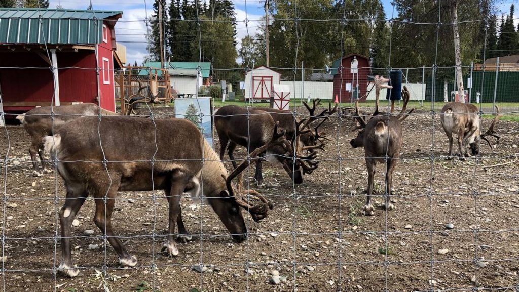
We came to the official end of the Alaska Highway in Delta Junction on Day 10 at Historic Mile Marker 1422. After making a stop at North Pole, AK and visiting Santa’s House (yes, I just had to purchase a couple things there) and viewed Santa’s Reindeer, we traveled the final 202 miles of the Alaska Highway to Fairbanks before turning south on the Parks Highway and headed for Denali National Park. Because I spent too much time in Santa’s House, we decided not to travel all the way to Denali NP but only another 55 miles and stopped for the night in Nenana – a small town of about 550 residents.
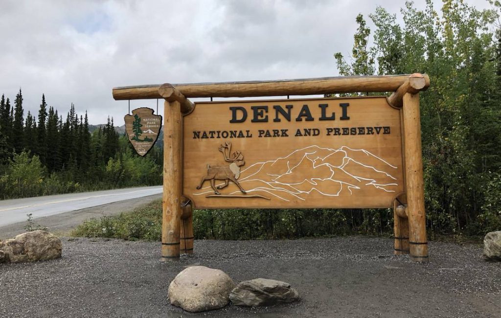
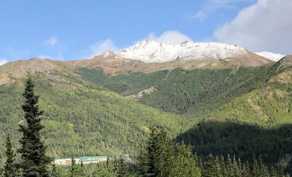
The next morning, Day 11, we packed up and drove the last 66 miles to Rainbow RV Park, set up camp early, and went for a drive into Denali National Park – as far as they would allow us to go. We stopped at the visitor’s center, which was pretty impressive, and then spent some time doing the tourist thing and checking out all the touristy businesses just outside the Park.
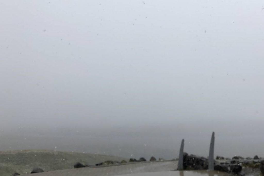
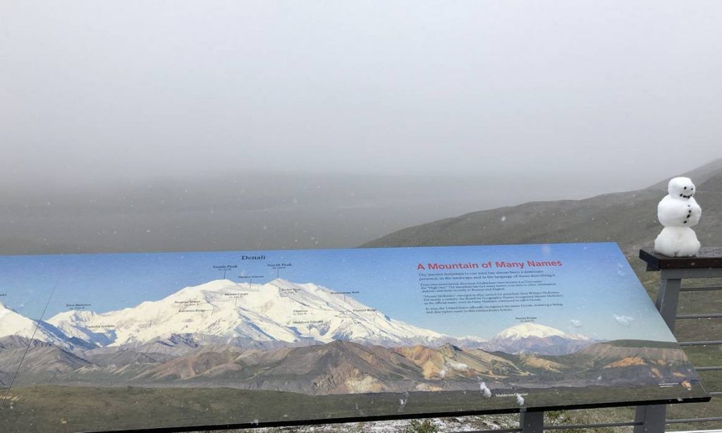
We retired for the evening early as we were catching an 8 am bus ride further into the Park on Day 12. As many of you know, Mt McKinley is only visible about 30% of the time. Well, this day was not part of that 30%. At Eielson Visitor Center (66 miles into the Park), it was all socked in and snowing and there was no sign of Mt McKinley at all.
Someone had even built a tiny snow man at the visitor center. But as we came back out, some of the fog and clouds had lifted and we enjoyed some pretty nice mountain views with new snow on top from last night’s rain/snow mix. We also saw some wildlife – a few caribou, two grizzlies, many Dall sheep, a black colored red fox, and many small critters and birds. So the day wasn’t a compete bust.
One thing that really struck us was that almost all the creeks and rivers in the Yukon and Alaska were braided and very cloudy with glacier silt. They appeared whitish and one of the rivers we crossed in the Yukon was named White River just for this reason.

Day 12 wasn’t part of that 30% of the time one gets to see Mt McKinley but Day 13 certainly was. As we headed down the Parks Highway towards Anchorage, we had gorgeous views of Mt McKinley for many miles. We stopped at the Alaska Veterans Memorial Park which was pretty neat and after traveling 229 miles, we set up camp at Eagle River State Park just north of Anchorage. It was a very nice place to camp – too bad it was right next to the highway.
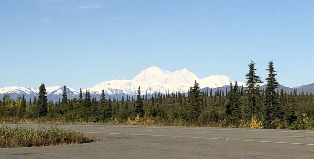
Our destination on Day 14 was Seward, AK – traveling only 137 miles. We passed through Anchorage and headed down the Seward Highway. As we were passing along Turnagain Arm of Cook Inlet, we came around a corner and WOW, another view of Mt McKinley and another day of that 30%. We were now well over 200 miles away from it.
Our goal was to get into Seward early so we could do some exploring. We pulled into Stoney Creek RV Park around 2:30 pm and no one was there to check us in. We waited around for about 30 minutes then decided to find a different place to stay. We’d passed by a sign for Bear Creek RV Park so we went back to them. When asking about a place to stay, we were told rather uncordially they were shut down for the season. So, it was back to Stoney Creek RV Park. We decided to just pick an empty spot figuring if someone else already had it they’d either tell us to move or choose a different spot. It wasn’t like there weren’t plenty of open spots.
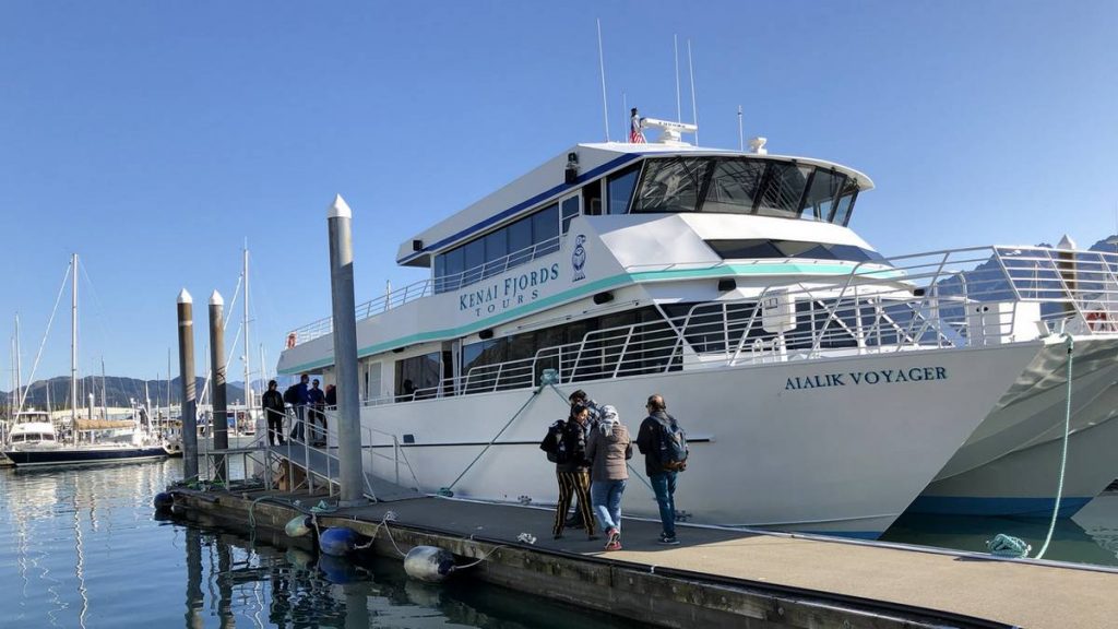
On our way towards Seward, we’d booked a tour on Kenai Fjord Tours for the next day.
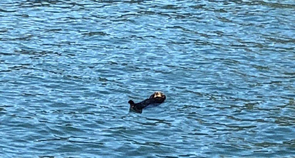
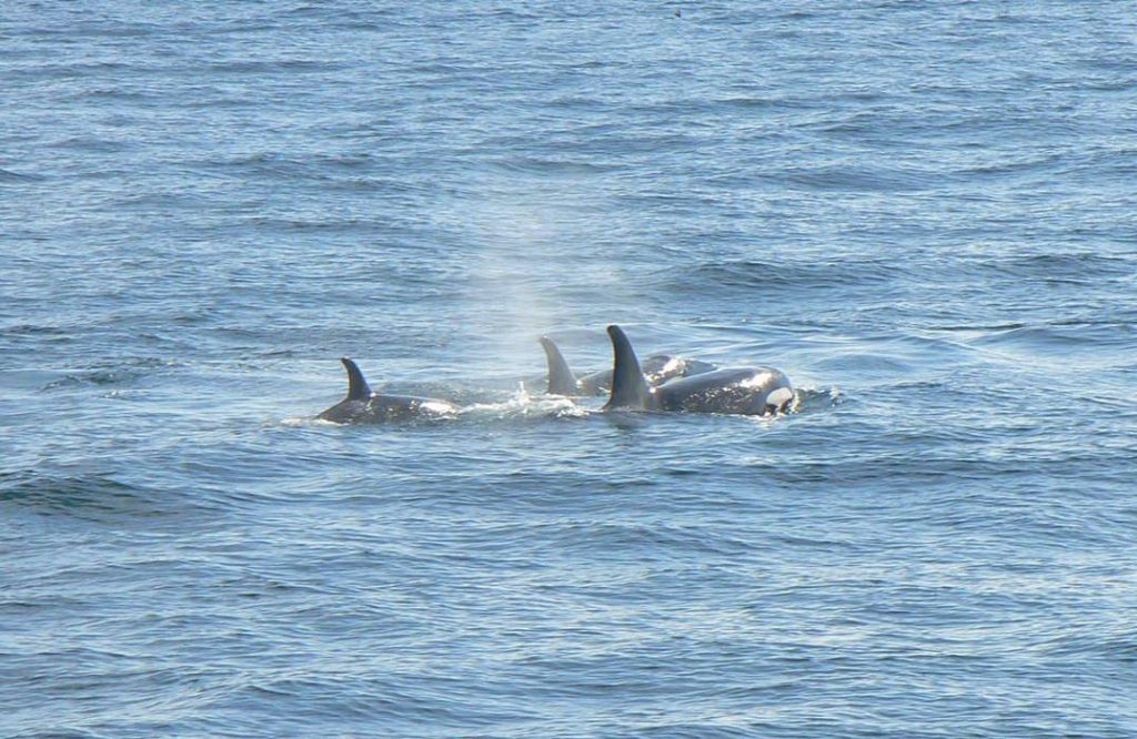
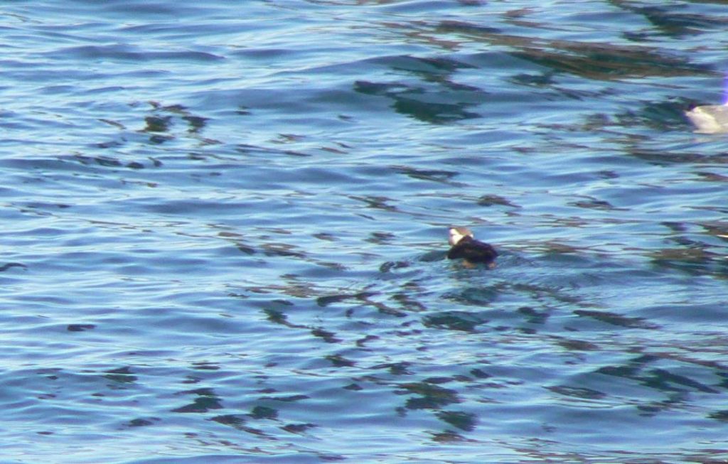
Spending the entire day (Day 15) with Kenai Fjord Tours on the bays around Seward was great. As we were leaving the harbor, we saw a sea otter just floating and relaxing among all the fishermen. He was really cute and put on a great show. Then we headed for bigger waters leaving Resurrection Bay towards the Aialik Glacier in the Aialik Bay. On our way we encountered a pod of resident Orcas. One of the crew said they only see the Orcas about 10% of the time so that was a real treat.
I must apologize for the quality of some of my pictures up to this point. I was using my iPhone and it wasn’t until I took the picture of the sea otter I realized my iPhone has a digital zoom whereas my Panasonic SLR digital camera has a 12x optical zoom. At this point, I used my digital camera most of the time – especially when taking zoom pictures – and what a difference it made.
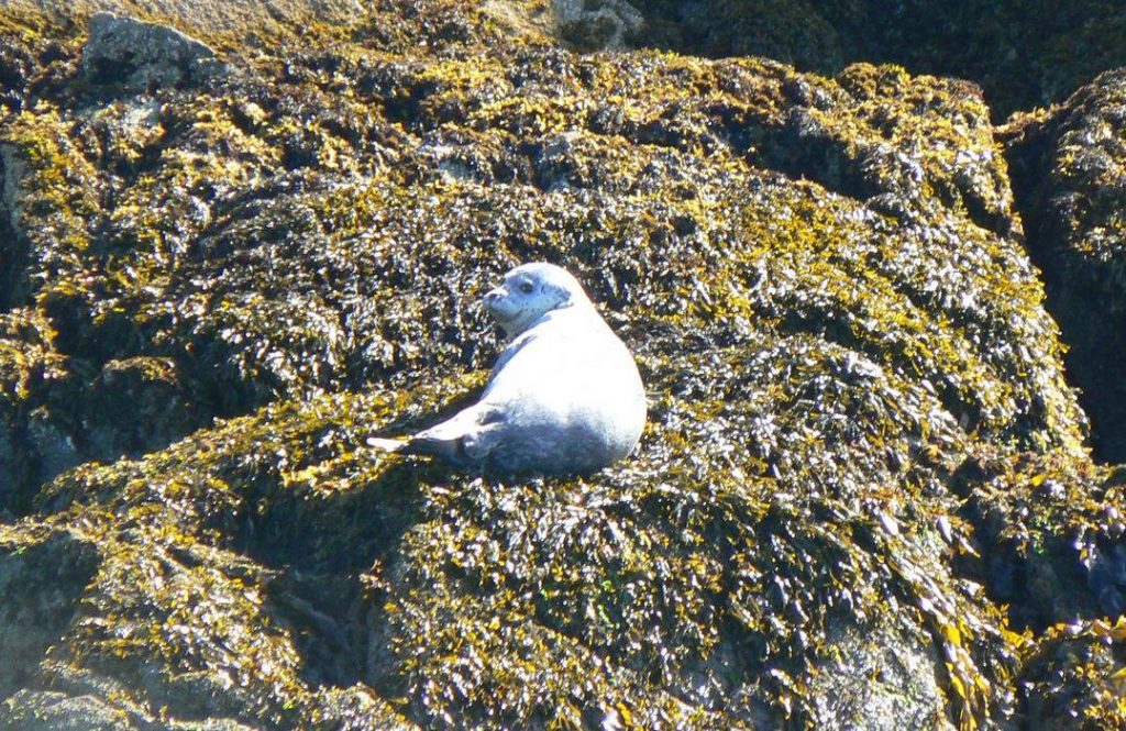
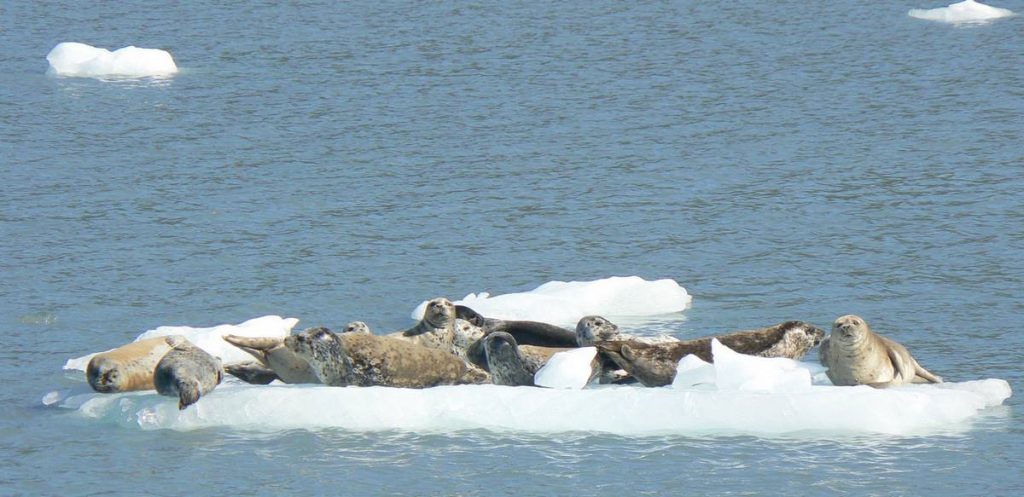
We passed by a harbor seal sunning himself on a rock – what a lush. But as we moved deeper into Aialik Bay and closer to Aialik Glacier, there were lots of harbor seals sunning on ice floes. They were so funny. Many of the ice floes had multiple harbor seals on them – sometimes up to 12. Captain Chad mentioned we’d see many more harbor seals. It was amazing to see the color variations of the harbor seals.
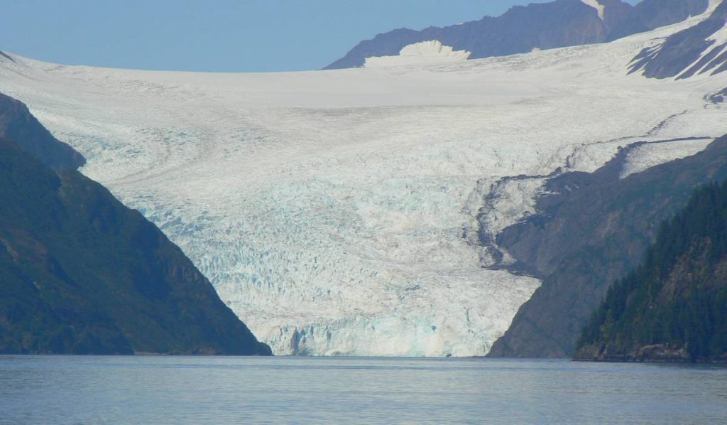
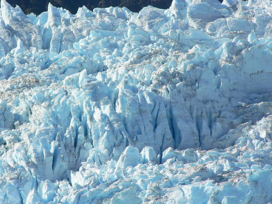
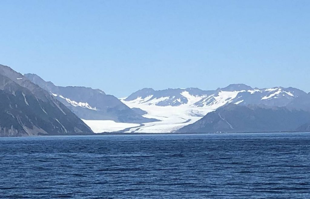
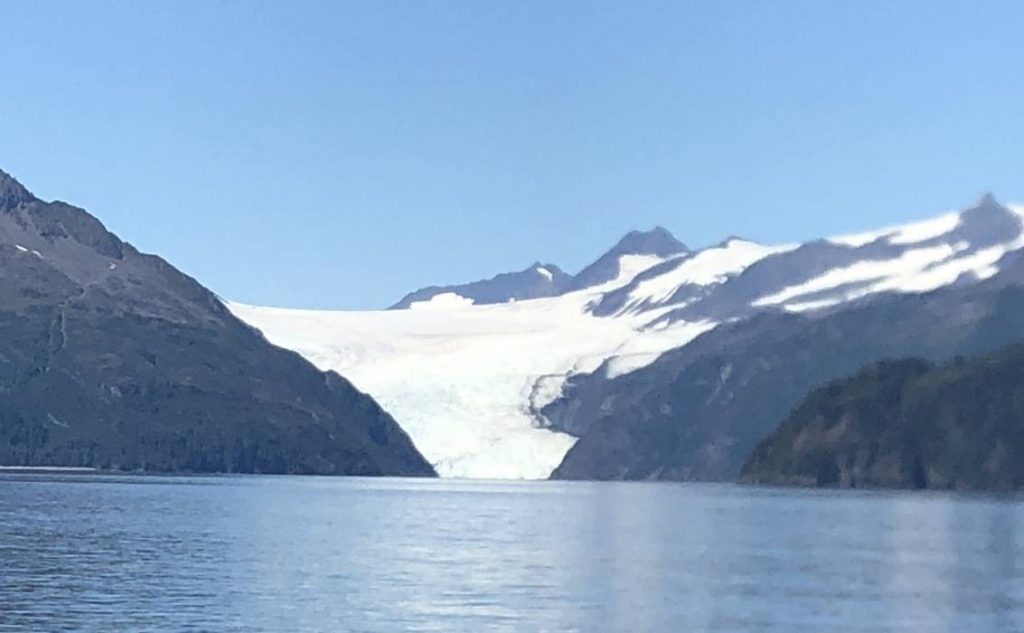
Even though we saw many different glaciers on this tour, Aialik Glacier was stunning. While we were there, it calved many times (dropped chunks of ice into the bay). Each time an ice chunk hit the water it made an enormous roar. And as the chunks of ice were breaking loose, it sounded like gun fire. Aialik Glacier is a huge glacier – 1 mile wide and 300-400 feet thick at waters edge. Captain Chad said it was one of the most active glaciers in Kenai Fjord National Park. The structure of the glacier was so stunning, Captain Chad said the blue coloring is caused by the density of the ice. It was very interesting to watch and listen to the glacier.
As we were leaving the Aialik Bay, that harbor seal was still sunning himself on the rock. We also encountered the pod of Orcas again. As the Orcas approached the rock with the harbor seal, he was scampering a little higher on the rock – that is as much of a scamper as a harbor seal can do. He was not about to become dinner for one of the Orcas!
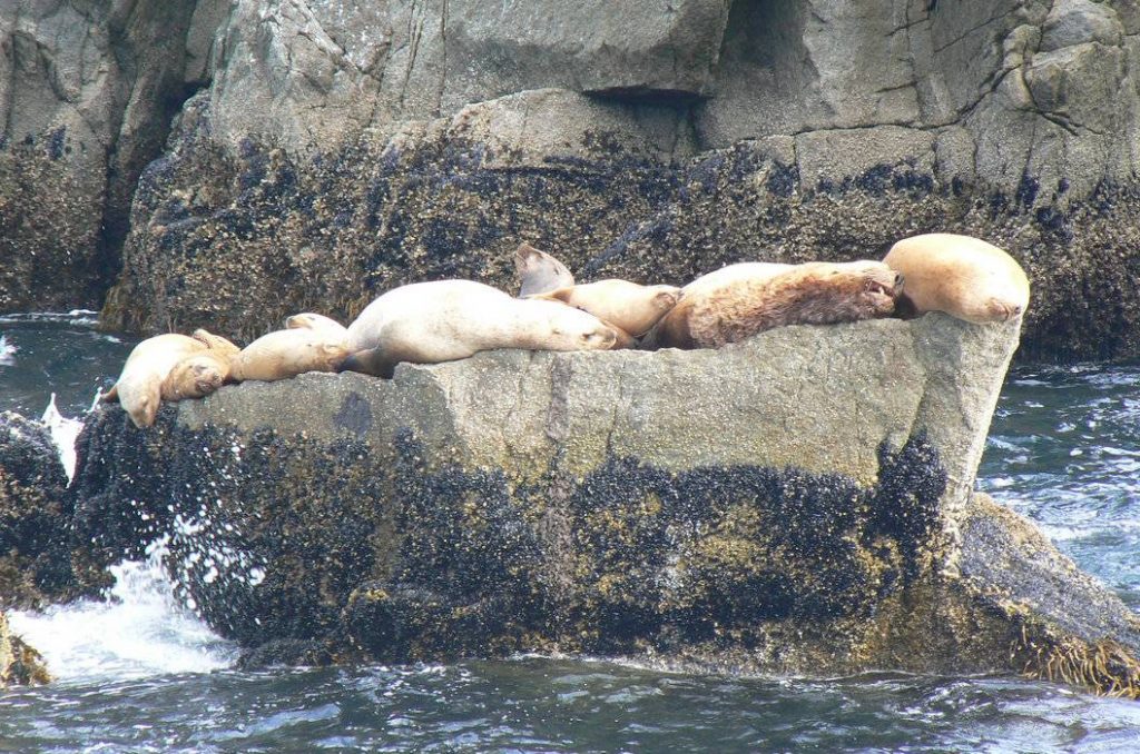
On the way back, Captain Chad took us by some islands where we saw Puffins – who were so fat they couldn’t fly – and sea lions sunning themselves on the rocks. The sea lions seemed to all like the same rock as there were more than a dozen crowded onto a single rock. All these critters certainly were taking advantage of this nice sunny day.
And as we were on our final leg back into Resurrection Bay, Captain Chad spotted a Hump Back Whale. The whale made one splash with his tail and disappeared underwater. No picture of him!! But what at a treat that was. And yes, as we returned back to the harbor, there were more sea otters putting on a show for us.
Now that we’ve traveled nearly 3,100 miles, we’ve reached the halfway point of this adventure. Although we have several more stops to make and things to see and do, tomorrow we start on our trek towards home.
A new post will cover the second half of our Alaska Adventure, stay tuned.